By Jim Farrell
OK, enough is enough. Even as diehard Northwesterners, our bodies and souls are craving a major vitamin ‘D’ fix after the ravages of this winter’s storms. A long trip to Hawaii or maybe South America or even the southern parts of North America would seem to be in order, but alas, there are obligations that must be met. So, we opt for what’s the next best thing to a southern vacation and as we feel the February warmth of the sun breaking through the water sodden cloud layers, and head to our boat with every intention of working on her topsides.
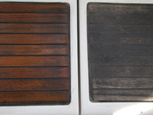
What we find when we arrive is the toe rail that was in want of repainting last fall before the rains hit needs attention badly, as the winter’s storms have done their best to strip the Cetol from it. The deck has green and black gunk forming on it, as the marina hasn’t turned on the water for fear of freezing all winter, and we haven’t been able to wash her. Unfortunately, just as we get to our “on the water home” it gets even more depressing and becomes impossible to work topsides, as the skies have closed-up with another storm hitting the northwest. Now is one of those times when you just go with the flow and retreat below deck to reorganize your thinking, and start planning your next summer adventure.
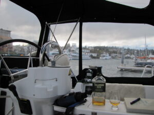
First and foremost is for you and your crew to decide where you want to sail, that will determine what needs to be done on the boat and what you must do to best prepare for a safe and enjoyable passage. As your setting below, enjoying a glass of wine (or in this writer’s case, Irish whiskey) and making a list: Here are a couple of questions or more to ask yourself before sailing in Pacific Northwest waters:
- What are the condition of the sails? Do they need re-stitched or replaced?
- What is the condition of your axillary engine? Hey, you live in the Pacific Northwest and believe this writer, there’s going to be many a day that your sails alone aren’t going to get you where you want to go and that’s when you’re going to use that piece of iron you struggle to change oil on.
- Speaking of that iron monster. Do you have spare parts aboard such as belts, filters, water impeller, line (that’s rope on a ship) lightbulbs, head parts (joker valve) and anything else that you think can possibly go wrong or will go wrong at the most inconvenient time, while sailing through the most desolate place?
- Is your tool chest filled with a wrench, screwdriver or allen wrench for every bolt screw and nut on the boat? (There may come the time that you wished you had).
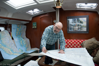
- Do you have paper charts for where you want to go? You’ll need them when your electronics fail, and they will, at the least, convent time…
…a little divergence here with an example this writer is a little too familiar with:
The first trip out of Portland with our brand-new Beneteau 423, S/V Autumn Daze, Becky (my sailing in life partner) and I decided to sail to Victoria for a week, then spend a couple of weeks on Barkley Sound on the way back to Portland. Perfect plan, and the first couple of weeks went as planned. A couple of days into gunkholing in the Broken Island Group, we woke up in the morning to find, to our surprise, no power. Nope…zip, none. A brand-new boat and all the batteries are dead…dead…dead.
When buying Autumn Daze, we had been strapped for the money to fully commission her with a generator or a tender along with its accompanying motor, therefore we were very dead in the water without even a workable radio. Ucluelet was 10 miles north and the closest port where maybe we’d be able to charge the battery or buy a new one; visibility was maybe 1/8th of a mile in heavy fog, seas heavy and our tender?… Well, suffice to say our tipsy plastic tender wasn’t going to be up to the trip, to say nothing about this writer’s ability to row 10 miles in heavy fog without any certainty of getting there this century.
Oh, did I fail to mention that it was about 45 degrees and 16 knots of wind? I seriously thought about sailing to Ucluelet, however sailing a 43’ vessel through a maze of islands strewn with rocks, many uncharted, with visibility just ahead of our bow, promised things could rapidly get worse. Given the situation at hand, I was left with no choice but to put on a life jacket, and start to row in our very unstable tender, with the tide.
My loving partner Becky was questioning my metal state just as she cast me off from Autumn Daze, with my handheld short range, CB radio (not marine), Coast Guard life coat, paper chart, compass, along with some water and food. As I started to row, I heard muffled voices penetrating the dense fog. Now I don’t know if it’s the luck of the Irish, or maybe Poseidon took pity on me, but the voices came from just on the other side of the small island, in a quite cove where it turned out that the Pacific Rim National Park Reserve had a floating cabin, manned by two park rangers. Four hours later, after a cold wet, foggy trip with the park rangers in their open inflatable, I was back with the new battery, and a lesson learned about excess power usage while gunkholing…
- Once you’ve decided where your next adventure is, have you entered in your chart plotter or computer navigation program? If you’re sailing up north, have you identified safe harbors along the route? A good reference guide is the folding chart “The Inside Passage, Route Planning Map”. The Southern Portion will help plan from the Columbia River to Grenville Channel, BC, and the Northern Portion on up through SE Alaska.
- Have you also drawn the route on your paper charts and started a trip log? Here’s a good place to decide what your trip log looks like. Becky and I’ve found that logging our position every hour in the trip log which with headings like; course, winds, wave height, weather, sightings (crab pots, fishing boats, flotsam etc.), barometric pressure and most important, latitude – longitude can be helpful to the oncoming crew. There is an additional benefit of plotting your ‘lat-lon’ on your paper chart, and that is on top of teaching crew members how to plot your position, when things go way wrong and you or your crew decide there’s an emergency, it takes only a quick glance to tell the Coast Guard where you are. It’ll also add a little distraction to help keep a sleepy crewman somewhat alert.
- How about your watch schedule? Knowing how many able crewmen aboard, and a Google search on watch standing schedules, will help you decide if you want a 4 or 6-hour or whatever watch.
- Do you have to cross the Columbia River Bar? Now that’s a big one. The Columbia River Bar is the second most dangerous water in the world; some say the most dangerous, and has well-earned its reputation as the graveyard of the Pacific. The best time to take the Bar is at slack flood, so be at the Bar an hour before high tide. This is the time that the ocean is pushing water into the river and the river is backing up, making for a somewhat smooth entrance-exit crossing. Keep in mind that flood slack tide is usually, sometimes, at times …. Or add any qualifier you may think of as being the best time…but no guarantee.
The Bar can and will change at a moment’s notice! According to the United States Coast Guard National Motor Lifeboat School located at the Columbia Bar, the best way to cross the Bar is to, “be as well-informed as possible. Call “Cape D” via phone 360-642-2382 or VHF channel 16 and let them know when you’re crossing. You can also tune to 1610 MHz on your AM dial to get the current bar conditions and weather. The Coast Guard will also send someone to their watch tower to observe as you cross and if by chance the worst happens, they will send a boat to pluck you out of the water.” They added, “Always, always wear a flotation device when crossing the bar.”
Each crossing of the bar offers a different experience. Sometimes heart stopping and leaving you wet and cold wondering why you ever left the familiar comfort of the home fires, while at other times the peaceful motions of the ocean swells meet you and the life of the Columbia Bar comes alive welcoming you to be a part of it.
- Are there rapids along your chosen route? Here, timing is everything. Paying close attention to the tidal currents, slack time is crucial for transiting them. A half an hour one way or another will decide if you’re going through at boat speed or bucking a 10knt current and going backwards. There are a few books out there such as Captn’ Jack’s Current Atlas, Charlie’s Charts-North to Alaska, Waggoner’s Cruising guide along with Ports and Passes, that’ll, for the most part, keep you out of trouble.
- Well, maybe not if you forget about daylight saving time and Alaska time. I do know a seasoned sailor (no names mentioned, but his wife won’t let him forget it) who misread the time by an hour when attempting a Seymour Narrows transit. He spent the better part of an hour moving basically 20’ ahead at full speed, skirting whirlpools 30’ across, then at the appointed time he should have attempted the passage, broke through at twice the hull speed. Another lesson learned.
Your list will go on with stores you’ll need aboard for the upcoming sailing adventure and many other items that you may never use and even forgot why you have them aboard but when the need arises, with luck, you’ll remember.
The bottle of wine is now empty, mother nature is still playing her rain song on the deck above you, and the wind is slapping the halyards against the mast of the boat next to you. Now’s a good time to stretch out on the cushions, pull the lap blanket over you and let the movement of the boat lull you to sleep where you may dream of the upcoming summer adventure and the elusive sunshine.
